Original

Igbo names and spellings for various settlements
Abakaliki is Abankaleke; Afikpo is Ehugbo; Awgu is Ogu; Awka is Oka; Bonny is Ubani; Enugu is Enugwu; Ibusa is Igbuzö; Igrita is Igwuruta; Oguta is Ugwuta; Onitsha is Onicha; Owerri is Owere; Oyigbo is Obigbo... any more will be added.
Showing posts with label Map. Show all posts

Sunday, December 15, 2019

Women's War: 1930 British Report Map

A map from an official 1930 British colonial government report on the Women's War of the Calabar and Owerri Provinces (1929-1930). The pink dots (enhanced) pinpoint places where "firing took place," the blue dots are Native Courts that were either damaged, burnt, or destroyed.

Wednesday, January 16, 2019

1699 Map of New Calabar

1699 map in French of the New Calabar River, a major centre of the slave trade. The map locates the “Ville du Nouveau Kalabar” (New Calabar or Elem Kalabari), “Ville de Bandi” (Ubani > Bonny), and "Ville de Doni" (Andoni), and some other places. Via slavevoyages.org

Friday, November 30, 2018

Green Sahara Event Map

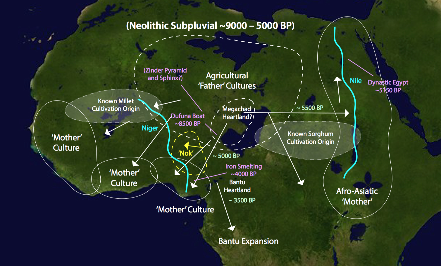
This is a chronological map for that completely conjectural Green Sahara migration theory. The dates are all of real events, one date about the supposed Sahara migration to the Igbo area (5000 BP), is also estimated, and the 5500 BP date of migration to the east is also a theory. All these 'coincidentally' happened around the end of the Neolithic Subpluvial, or when the Sahara went dry.

In this theory, Megachad, the original size of Lake Chad, is probably the heart of the Sahara population.

More information about the theory see The Wet Sahara: A Practical Approach to the Question of the ‘Origin of the Igbo people?’